Google Maps
First look
Requirements of Google Maps' Design
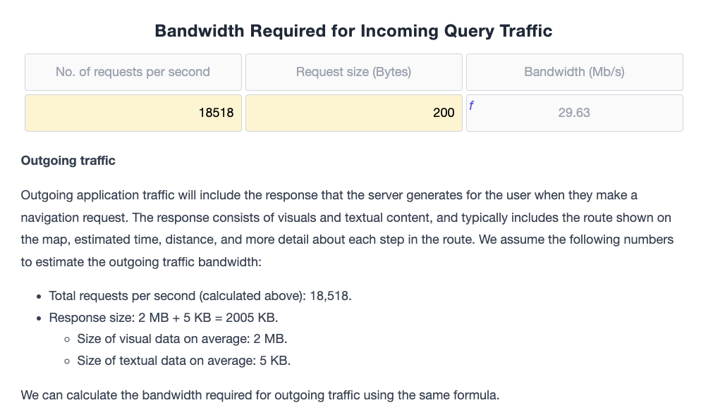
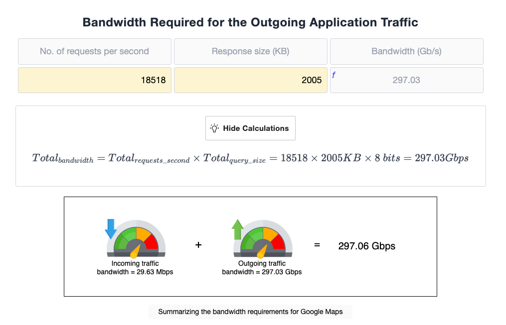
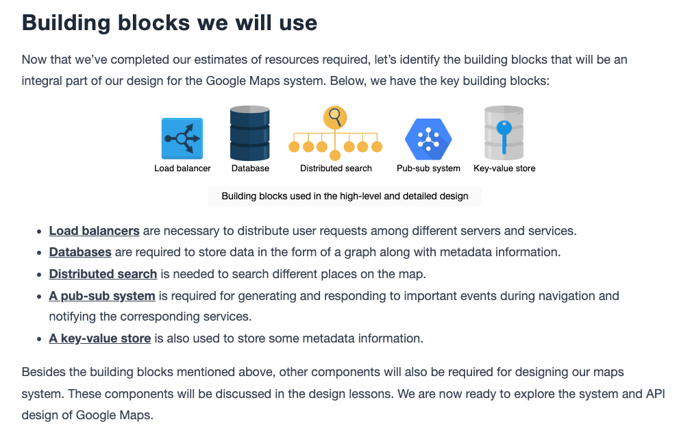
Design of Google Maps
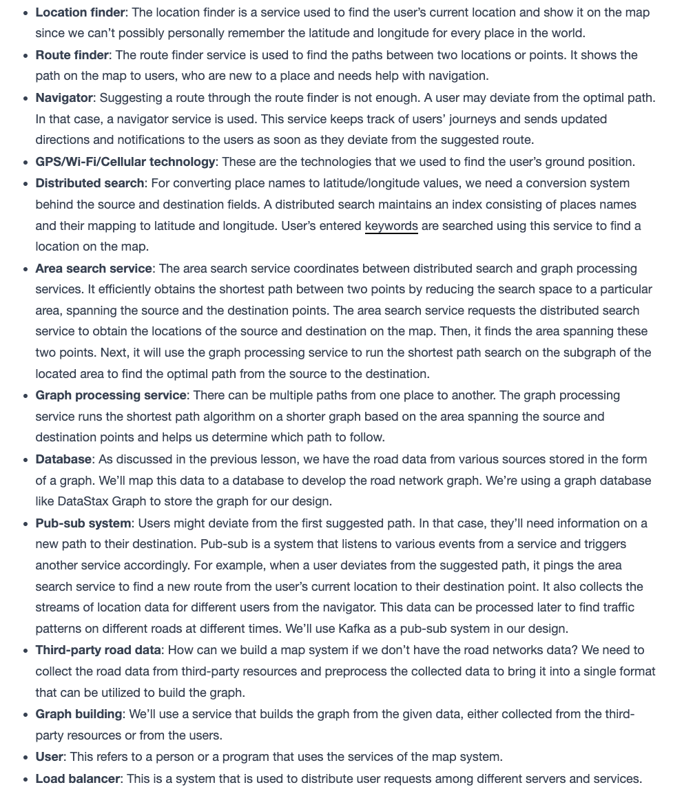
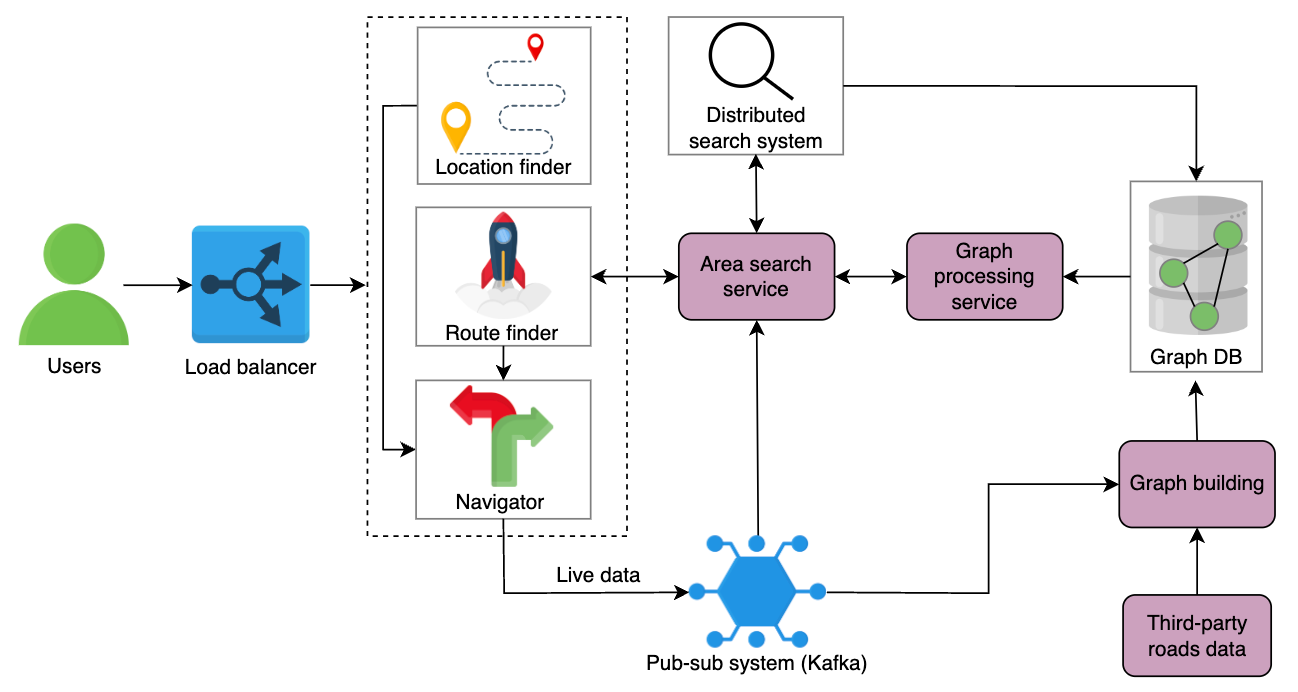
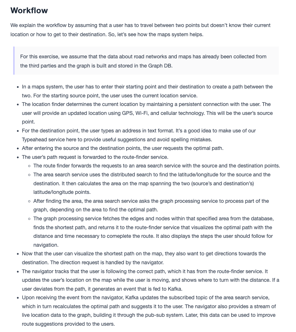

Details
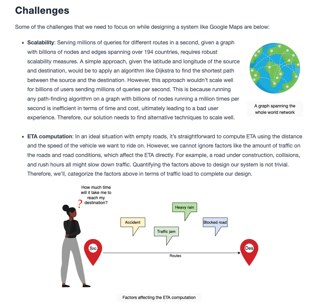
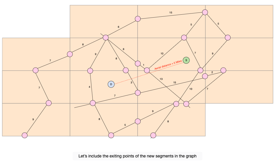
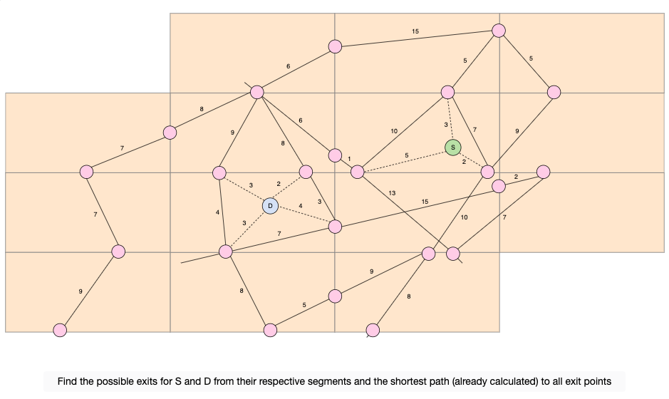
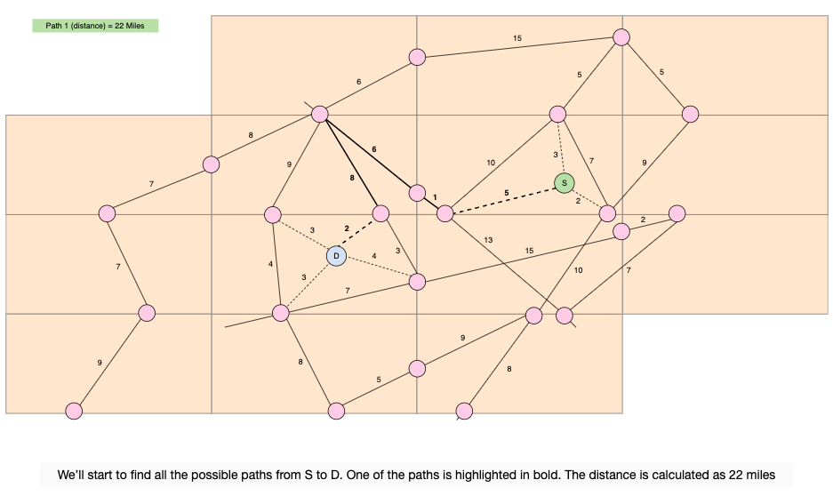
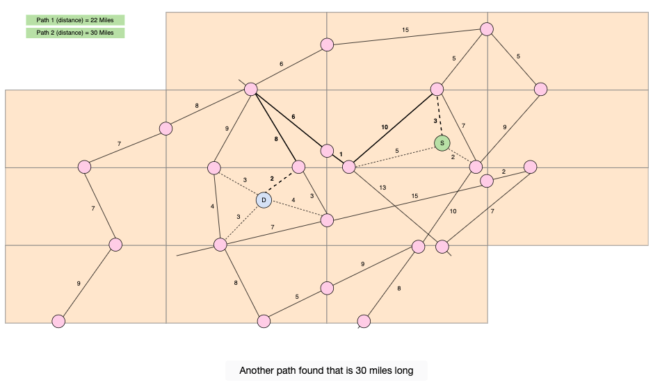
To collect real-time congestion data, we can use GPS readings from user devices, ensuring privacy is maintained, along with traffic sensors and incident reports. This data is then integrated into the route-finding process by updating the weights of the edges in the graph that represents the map. This might involve using a time-dependent shortest path algorithm to account for varying traffic conditions at different times of the day, ensuring that the routing is dynamic and reflects current traffic realities.
Challenges of Google Maps' Design
Detailed Design of Google Maps
Evaluation of Google Maps' Design